The Oregon Trail: Days Six and Seven

The Oregon coastline

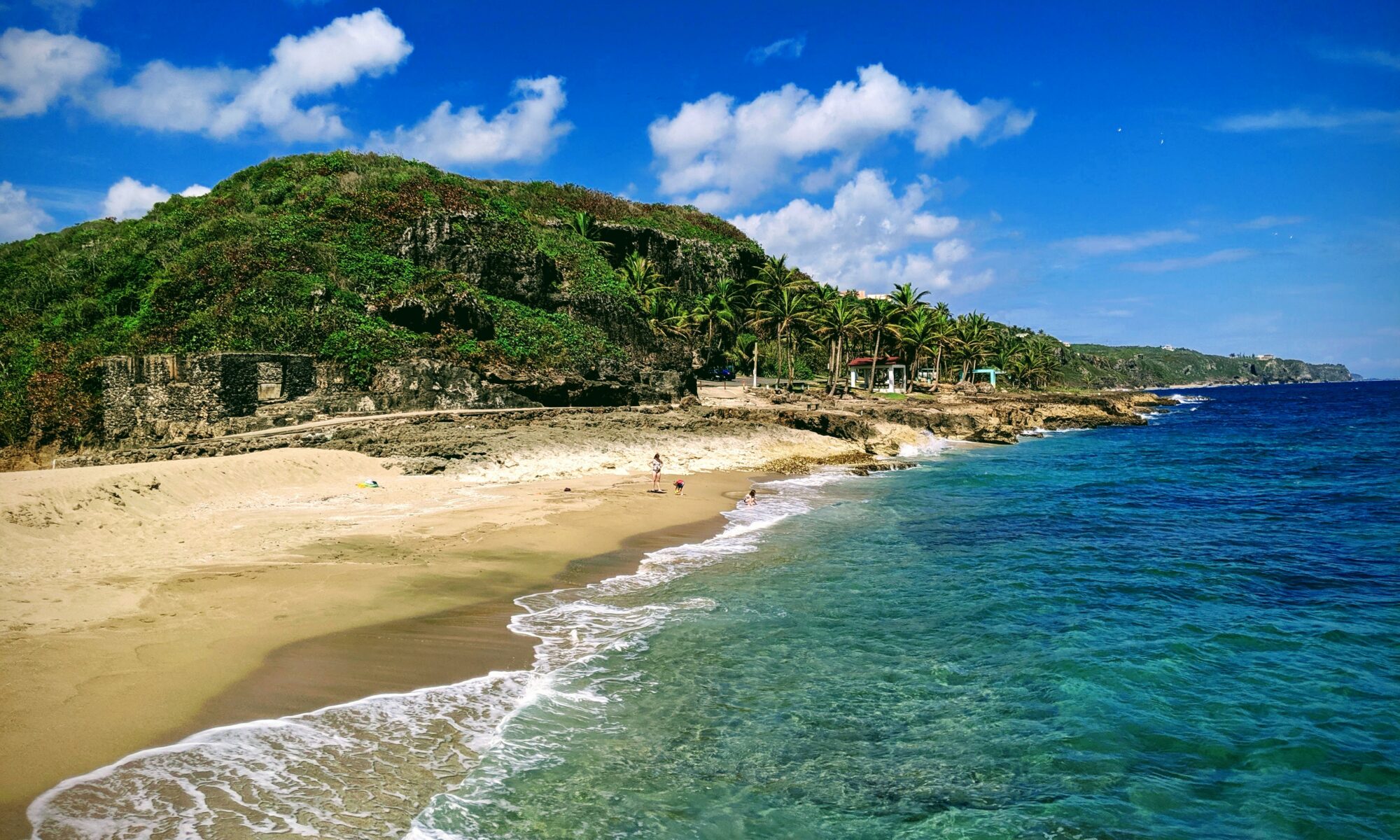
We left Portland on Saturday morning and, rather than take the interstate down to San Francisco, we opted for the coastline via US-101.  Is this a longer trip?  Yes.  Is it much more interesting than taking I-5?  Absolutely.  US-101 connects up with the famed Pacific Coast Highway (CA-1), so it’s effectively the Oregon leg of that roadway.  For much of the trip, we were driving along the Pacific coast, which Brooke hadn’t seen before.  We stopped off at a beach or two to check it out and, believe you me, that water was cold.  We saw multiple cars with surfboards on top as we made this trip and never saw a single surfer actually in the water.

It was two-lane highway for much of this trip, but we had intended this to be a day-long drive down toward California.  Thus, we weren’t really in a rush or anything.  We stopped off at a seafood restaurant, Mo’s, to get the “local seafood treatment” (though what I ate was just fried fish from Alaska, so not that much fresher than what I’d get at home…oh well…).

Dirty tree hugger...
Dirty tree hugger…

The coast of Oregon took a few hours, and then US-101 headed inland.  We’d return to the coastline after awhile, but first we got to drive through the Redwood Forest (which is one of the main reasons we took this route instead of I-5).

Know what?  Those trees are big.  Really big.  Your encyclopedia collection didn’t lie to you.

As you drive through, you marvel at how tall the trees are.  Granted, I’ve seen some tall trees, so in some ways, these don’t seem that tall.  But when you actually get out of the car and stand next to one of them, your perspective changes a bit.  The tree above, located near a pull-off parking area, was just some random tree: it isn’t a special “biggest tree in the forest” or anything.  It’s just that they’re all this big.  Which is crazy.

We’d like to return here someday to do some camping and hiking.  We just didn’t have the time on this trip to spend very long, but we’re really glad we passed through the Redwood Forest.  It’s one of those things you can look at in pictures, but can’t truly experience until you stand next to one.

Vineyards through the car window.

US-101 weaved back to the coast for a bit, and then continued inland toward San Francisco.  We stopped in Redwood Valley, CA for the night at an Airbnb house.  This was our first experience using Airbnb and we were pleased with the results.  The house we stayed in had a separate apartment area with a mini-fridge, its own bathroom, a queen-size bed, a table and chair, and had its own access out of the house.  I’m quite sure this was a dice roll that could have turned out poorly, but based on the reviews for the woman we stayed with, and the location, we went with it and were pleasantly surprised.  I think we’d definitely recommend Airbnb again as an option for a place to crash for the night, but just make sure you look at the reviews and make sure you’re fine with the accommodations being offered (i.e. if you don’t want to stay in some grandma’s basement on her couch, don’t do it…because those places are on there and the experience will be just as they describe).

Redwood Valley, CA is less than 2 hrs from San Francisco, so we still had a little driving to take care of the next morning.  It’s also about 70 mi from Napa Valley, so there are tons of vineyards along the route.  And when I say “tons,” I say “you know how much corn we grow in Iowa?  Well, imagine an Iowa cornfield of grapes and that’s what you’ll see.”  Seriously, the vineyards in Missouri near Hermann simply can’t compare, just in sheer volume.

One thing we noticed as we made this leg of the trip through northern California was the lack of water.  California is going through a pretty serious drought this year and it was evident almost as soon as we left the Redwood Forest.  You can see in the picture above some healthy vineyards, but the dry grass underneath.  Among the trees in the background, you can also see dry fields of grass.  An errant match could pretty easily take up all those grapes in minutes.

A beautiful morning near Golden Gate Bridge.

After a few short hours, we crossed into San Francisco via the Golden Gate Bridge.  It was a lot bigger than I expected!  US-101 is what crosses it, so it wasn’t exactly hard to find.  It’s 6 lanes wide with some walking/biking in the middle.  Due to some construction, it took us a few minutes to figure out how to get this picture, but we eventually got to the grounds of the Presidio to take a look around.

Once the requisite pictures were taken, we found a place to park (for far cheaper than in Portland…) so we could walk toward Alcatraz.  As I’m a big fan of “The Rock,” I actually kinda wanted to check out the site, but it would have taken hours to take the ferry to the island and then take the tour.  In some ways, thankfully, the decision was made for us, as tours were all booked through mid-August by the time we checked in mid-June.

The Palace of Fine Arts

So, instead we walked toward the Bay so we could at least see it from the shoreline (it’s visible from the Golden Gate Bridge, too).  On the way, we accidentally walked through another site from “The Rock,” the Palace of Fine Arts.  We didn’t really know what these buildings were even there for (apparently they were built in 1915 for the Panama-Pacific Exposition, so it’s kinda like their equivalent of St. Louis’ Forest Park and the 1904 Worlds Fair exhibits).  I think I was a bit more impressed than Brooke was, but the buildings were all pretty cool and the grounds were beautiful.

"Welcome to The Rock."
“Welcome to The Rock.”

Eventually, we cut through the multitude of tourists on bicycles and got to the coastline where I could get a picture of Alcatraz Island.  Here is my picture of Alcatraz Island.  I’ve been close enough to “The Rock” to take a picture.

I’m satisfied.

"Everywhere you look..."
“Everywhere you look…”

Speaking of “being close enough to take a picture,” we also saw the “Full House” house.  Not much to say here except yeah, we totally drove by it.

The Mission district.

The last thing we did in San Francisco was check out The Mission district, which is where much of their Hispanic community calls home.  They also have quite a few restaurants and “Mission-style burritos,” where they were obviously invented and appropriated by the likes of Chipotle and Qdoba.  This area of town felt a bit “seedier” than where we were taking pictures of Danny Tanner’s fictional house, which was great because it also felt less touristy than what we’d already seen.

After that, we took off!  It was early-afternoon and we didn’t have anything else we really wanted to commit to for the next few hours, so we headed east, back home.  That night, we stayed at a KOA in Winnemucca, NV (after stopping off at our first In-n-Out Burger in Reno, NV), and then continued for a really long 14 hr day to Limon, CO.  The next day, we had an 8 hr drive home and that was it!  Though taking the interstate was far more boring than the initial trip out, it was good to “book it” home, as we were both in the mood for our own bed and consistent Wifi access.

It was a great trip!  Lots of memorable moments and cool things to see along the way.  We aren’t sure we’d change much about it, but I think we’d both like to hit up the Pacific Northwest again someday, perhaps when the kids are old enough to go hiking with us in the Redwood Forest, or have a beer in Portland.

Now.  What do do for our 15th Anniversary…hmmmmm

The Oregon Trail: Day Five

Portlandia
Portlandia

Yeah, I know: we already did a “Day Five” post…but it didn’t really address Portland.  Part of the genius of this Oregon Trail adventure of ours was that it would take us out to the Pacific coast, allowing us to see Portland, the Redwood Forest, and San Francisco before returning home via boring interstate highways.

We stayed at a Ramada in Portland for a few nights, getting much needed rest in actual beds with actual Wifi access (i.e. things we hadn’t really experienced for the previous 4 days…).  On Friday, July 10th, we explored Portland (and visited Oregon City in the morning).

Parking was something of an issue.  We tried heading up from Oregon City directly into Portland (15 min drive?), but quickly discovered that parking in downtown Portland on a Friday after 10:00 am is all but impossible for a reasonable price (or really, at all, for any price).  So, we drove around a bit before deciding to head back to the hotel, where we could leave the car and hop on their light-rail system to hit downtown.  Yes, it was backtracking and, yes, it took 45 min to take the train to get downtown.  But, once we were there, our lives were much easier.

Brewer's Choice sampler at Deschutes Brewery
Brewer’s Choice sampler at Deschutes Brewery

It appears that you can’t throw a rock without hitting a brewery in Portland and, while I would have loved to spend the day just hitting every brewery we could, that would have limited our ability to do other things (we’ll have to go back!).  Thus, we stopped by Deschutes Brewery for some appetizers and a few beers.  They’re a national brewery, at this point, but the stuff we tried isn’t bottled and is more limited to the Portland region.  It felt a lot like Schlafly Bottleworks, though I’m sure Schlafly modeled themselves after northwestern breweries when they formed decades ago.

Powell's City of Books
Powell’s City of Books

Near the brewery, we also stopped at Powell’s City of Books.  Yes, it’s “just” a bookstore, but it’s a really big one that takes up a full city block and is a few stories tall.  Just about any book you could imagine was here.  We picked up a few books for the kids as souvenirs (parents of the year!), but were really just in awe of how many books you could cram into this space.  Definitely worth a stop if you’re in town.

Stumptown Coffee
Stumptown Coffee

As we were in Portland, we also had to partake in local coffee wares.  Much like beer, the options for coffee in Portland are almost limitless, but it sounded like Stumptown Coffee Roasters are perhaps best-known and end up providing a lot of their beans to the other coffee houses in town.  In the end, it was really just a regular ol’ coffee shop, but at least we can say we had fresh coffee in Portland, right?

Pioneer Square
Pioneer Square

We walked by Pioneer Square on our way to dinner.  I guess this is their equivalent of Jackson Square in New Orleans, a location where you may hear live music, where there are local street vendors with food and souvenirs, and just a general gathering place for tourists.  Really, we just walked on by after seeing it…

Luc Lac Vietnamese Restaurant
Luc Lac Vietnamese Kitchen

The last thing we did was eat dinner.  Believe you me, the options in Portland are wide and ranging, but considering we’d had fast food, American-style food, Italian food (Brooke did, at least…) and knew we’d have Mexican down in San Francisco, we figured something more Asian would be a good idea for a change.  Luc Lac Vietnamese Kitchen had a lot of great reviews on the intertubes and we had a recommendation from a Portlander, so we gave it a go.  The place was packed, and it only got worse after we got our table…and we were there around 4:30 or 5:00 pm.  We got a smattering of different dishes (the small plates above were $2 each) for exposure to a lot of options.  Good stuff!

After that, we went back to the hotel.  By this point, we were ready to just chill for the rest of the night, as we’d be hitting the road again toward San Francisco shortly…

The Oregon Trail: Days Four to Five

A display showing an aerial view of Three Island Crossing

After leaving Twin Falls, we headed toward Three Island Crossing State Park, a stop along the Snake River, where emigrants traveled after they left the Platte River way back in Wyoming.  The western desert of Wyoming was treacherous, and there were days of travel between leaving the Platte River and finding the Snake River.  For much of Wyoming and Idaho, the Oregon Trail follows some unreliable creek beds, so water was pretty scarce, potentially for weeks, depending on the time of year you were trying to cross the territory.

Thus, in this whole region, the landmarks for us to see were a bit more sparse.  It was very much like crossing a desert: few gas stations, not much water, not many communities.  Harsh territory where many emigrants lost their lives, unfortunately.

Three Island Crossing was a more lush area though, with grass and water, and a thriving Native American community (i.e. supplies).  In this area, the pioneers shared resources with the Indians, at least for awhile.

We didn’t take a plane with us, so getting this aerial view of Three Island Crossing wasn’t doable.  Thus, I present this picture (above) to illustrate how difficult it was to cross large rivers (like the Snake River, here in Idaho) and how there are certain locations (like this one) that are targeted by emigrants heading west to Oregon and California.  The yellow line on the display shows how the wagons got across, moving from island to island until they got to the other side.  Even with this crossing, many wagons still didn’t make it, or got stuck on one of the islands while trying to cross.

Alternatively, if you had the money, you could always take the ferry across, nearby.

A full-scale replica of a ferry at Glenns Ferry, ID.

At Three Islands State Park, they also had a full-scale ferry you could see, but sadly couldn’t actually use.  Again, this wasn’t a cost-effective option for many travelers, but in 1869, if you had the money, it was safer than trying to ford the river.

From Three Islands State Park, we continued west along the Snake River toward the Columbia River, but again, there wasn’t much to see on this leg of the trip.   We did stop near Boise, ID at the Oregon Trail Historic Reserve, which is really just a walking park around some distinct wagon ruts.

Some more wagon ruts.

It was nice, but nothing worth writing home about (except here…obviously).  Again, there just wasn’t much we were interested in seeing as we went through Idaho.

For example, there are multiple forts along this track, however a). we’d already seen a bunch of cool forts, and b). the “forts” that they had to see were replicas, not actual buildings from the time period.  Fort Hall was an important stop along this portion of the trail, but the only thing there is a “replica museum” that over-charges people to see it.  Fort Boise was a British garrison, and also important, but again, there’s a monument left in Parma, ID and a “replica site” of the trading post open limited hours.  Thus, we found these sites to be skippable.

Fort Bridger was on the Wyoming side and we skipped it.  It’s possible this site would have been cool, as it had a few buildings left and some museums.  However, the Oregon Trail diverges at this point where some emigrants didn’t actually go that far south.  Depending on whether you were on the Mormon Trail or the California Trail, you’d want to head through Fort Bridger on your way to your destination.  The early travelers of the Oregon Trail likely went through Fort Bridger, but it looked to us like the trail heads north along Hams Fork and Craven Creek (current highway US-30).  Perhaps it depended on the time of year for whether you’d stop at Fort Bridger, or if you’d keep on heading westward.  Either way, it shaved a few hours off our trip, so we skipped it.

Back to Boise, ID though.  We passed through Boise (and stopped at a local Sierra Trading Post, which was sadly disappointing) and then crossed into Oregon.  Unfortunately, it turns out that Oregon doesn’t have an Oregon Trail Guide available through the National Park Service.  Crazy, I know.  All the other states have them, but not the state the Trail ended in.  Therefore, we didn’t really have specific sites to stop at.  Also, at this point, the trail kinda just follows I-84 all the way up to the Columbia River Gorge, so that’s what we did: drove on the interstate for awhile.

Columbia River Gorge

After hours of interstate driving though, we reached our destination: the “end” of the Oregon Trail.  Technically, this was the end of the overland portion of the trail, as following the Columbia River into said gorge meant that at some point, wagons could no longer actually follow the river and had to travel on the river to get to the Willamette Valley.

So, on July 9th, we reached the “end” of the Trail.  But, it wasn’t the “official” end.  That’s in Oregon City.  However, the End of the Oregon Trail museum closed after we got there that night.  So, we stayed in Portland (more on that in another post) and went down to Oregon City on July 10th.

The End of the Oregon Trail Museum

This museum was a bit disappointing, methinks.  Maybe we played it up in our heads a bit.  Perhaps we’d just seen a lot of other museums on our trip.  Who knows.  Regardless, while the outside of the museum was pretty cool (with the large structures resembling wagons), the inside was disappointing.  They had a mock General Store (representing the beginning of the trail); they had a display of “Trail Medicine” (which looked like an undergraduate history project…mostly some written displays and some antique bottles with spices in them…); and they had a genealogy station set up in a room mocked up to look like a place to register your land.

Which, by the way, is the reason Oregon City was the “official end” of the trail: Oregon City was the closest location in the region where you could register your land claim.  If you came to Oregon on the Trail to get land, you had to go there.

The video shown at the museum was actually pretty interesting, as it just consisted of readings from diaries of emigrants on the Trail.  Though it largely told the same story that we’d heard for 2000 mi, it was interesting to hear it from a first-person perspective.

The Willamette Valley

While in Oregon City, we took a quick walk along the valley to get a better look at what emigrants saw when they got here.  Sadly, it’s a bit more “industrial” than what was there 150 years ago, but we got a sense of the place.  It was definitely a far cry from the landscapes we’d seen on our travels through Nebraska, Idaho and Wyoming.  A fitting end to a treacherous journey.

That was it!  We’d made it!  It took us 4 days (technically, though we didn’t visit this museum until Day 5…) to cover what used to be a 4-6 month journey.  By this point, we were ready to not be in the car for 10+ hrs a day, so we enjoyed Portland a bit.

But that’s for another post…

The Oregon Trail: Day Three

Independence Rock
Independence Rock

Day three started off at Independence Rock.  It got the name because if you weren’t as far as this landmark by July 4th on your trip to Oregon or California, you probably wouldn’t make it before the first mountain snowfalls west of here.  Technically, we were there after July 4th, but we didn’t run into any snowfall.

"B. Snow, June 10, 1853"
“B. Snow, June 10, 1853”

Names were carved into the face of the rock. We only got pictures of a few of them, as neither one of us wanted to ascend the entire formation, and there weren’t exactly signs pointing to the specific locations where these carvings were to be found. Still, we saw a few of them. It was one of those times where you think about how “Wagon Train Along Oregon Trail” is non-specific, where you don’t necessarily think about individuals along that trip that made the journey and survived or perished.  Here are instances where you see evidence of “B. Snow,” or other specific people that were at that specific location 150+ years ago.  Crazy.

Near South Pass.
Near South Pass.

From Independence Rock, we continued another few hours to South Pass, which is at the Continental Divide.  It looks quite a bit different up in Wyoming than it does down in Colorado (we saw that too, incidentally, on the return trip), as it’s flatter and eminently more “passable” for a group of wagons than the Rocky Mountains are.

Of course, now, there’s an interstate highway system (Interstate 80) that makes its way just south of this location, but being the historically accurate explorers we are, we took WY-28 to get here.  Technically, there’s only a brief rest stop at this location, but nearby, there’s a dirt road that goes off into through some fields to get to the real “South Pass.”  And guess who has all-wheel drive?

The crazy people that went to the real "South Pass."
The crazy people that went to the real “South Pass.”

The road really wasn’t all that bad, but we were still glad we had the additional ground clearance and AWD, as there were more than a few times where one side of the Forester was a good 12″ higher than the other side of it.  Rain was coming in, so we didn’t stay too long, but we got a feel for how high up we were (about 7,500 ft), yet how flat it was.  It was no wonder why the wagons went this way rather than through the Rockies.

Stone markers commemorating Ezra Meeker and Narcissa Whitman.

While we were at South Pass, we also saw a few markers left in honor of two famous travelers: Narcissa Whitman (left) and Ezra Meeker (right).  Whitman was the first European-American woman to cross the Rockies.  She was a Christian missionary that made the trip around 1836 and largely proved that women could make the trip, paving the way for families to come out.

Ezra Meeker made the trip in 1852 when he was 22.  From 1906 to 1908, convinced that the Oregon Trail was going to be forgotten, he made a much publicized trip along the Trail by wagon, placing monuments along the way (including this one).  He did it again by ox cart from 1910-1912, and by plane in 1924.  Note that he was in his late 70s when he made these wagon trips.  Regardless, his work is largely responsible for the trip we were able to take 100 years later.

Soda Springs.  Free-flowing Pepsi, mostly.
Soda Springs. Free-flowing Pepsi, mostly.

By this point in our journey, we were running low on things to see.  That is to say, points of interest along this portion of the trail become more sparse.  At least, monuments and big things become more “sparse,” while grave sites and famous Indian War battle sites start to predominate.

Soda Springs, however, was mentioned in the Oregon Trail game and was definitely worth the stop.  Sure, we’ve got spring water in Missouri, and “hot springs” down in Arkansas (among other places), but at this intriguing site, the spring water is naturally carbonated.  There are multiple springs in this area, and Hooper Spring was one of the more famous locations.

Probably didn't look like this when they were getting drinks 150 years ago...
Probably didn’t look like this when they were getting drinks 150 years ago…

Obviously, this isn’t what it looked like back then, but you can still hear the water bubbling as it comes up out of the ground.  It’s a nice little stop, though this particular spring is surrounded by mining and construction, so it isn’t quite as picturesque as some of the other places we stopped.  Still, if you’re ever in the area, it’s worth a quick stop.

After stopping at Soda Springs, we booked it across Idaho to the Twin Falls/Jerome region, had dinner, and stayed at a KOA in the back of the car for a night.

Only one more day on the trail!  Next stop, Oregon City!

The Oregon Trail: Day Two

Which way are we going, again?

So, after the not-so-awesome first night’s sleep in the back of the car, we continued toward the nearby Fort Kearny State Park.  Fort Kearny was one of the early well-known stops along the trails, a trading and restocking depot along the California, Mormon and Oregon Trail systems.  It went through a few face-lifts during its years of existence, but importantly, it was established by the US government as a service to pioneers heading west along the Platte River.

Fort Kearny...an early stop along the trail for supplies.
Fort Kearny…an early stop along the trail for supplies.

The Platte River, we would find, was an essential lifeline to the early pioneers as they crossed Nebraska and into Wyoming (where things would get a lot worse).  It’s an odd river in that it’s somewhat shallow at many points, but it also gets muddy and changes its shape/location readily.  It was also important to the Native Americans of the area, which means the pioneers and Indians were in close proximity, sometimes leading to conflict (hence the need for a Fort at this location).

The state park grounds were interesting, including quite a few replica buildings and the outlines of where previous buildings were.  This site wasn’t well-maintained from its time as a fort, as most of the materials were dismantled around the time the transcontinental railroad was completed (another theme throughout the trip, as nearly every museum would bring up that the trail effectively ended once the train system was completed).  After that point, there wasn’t much need to protect travelers, so the fort was abandoned and eventually turned over to the Nebraska state government.

Courthouse and Jail Rocks

After leaving Fort Kearny, we passed multiple rock formations that were frequently mentioned in the diaries of those traveling the trail.  Courthouse and Jail Rocks were the first…

Chimney Rock
Chimney Rock

…followed by Chimney Rock.  Courthouse and Jail Rocks had a pull-out off the highway near Scott’s Bluff, but no visitor center.  Chimney Rock, however, had a decent visitor center with some displays of artifacts and another video.  By this point, we were noticing that most of these videos told the same story for 10 minutes, followed by 5 minutes that discussed the exact feature you were seeing.  Still, it was interesting to listen to the evolution of how the trail was discussed, where early sites appeared to focus on the railroad system coming in, while later sites seemed to shift that focus more toward how Native Americans were more of a help than a hindrance to the pioneers.

Fort Laramie
Fort Laramie

The next stop, just over the border into Wyoming, was Fort Laramie.  Here, in one day, we had a stark reminder of the difference between a state park and a national park.  Where Fort Kearny had replica houses and somewhat chintzy displays, Fort Laramie still had original buildings and displays within those buildings to show how things were set up, including period-specific furniture, clothing, dishes, etc.  If you’re going to pick one, you definitely want to visit this one (mostly because it’s free…your tax dollars at work!).

Much like Fort Kearny, Fort Laramie was there as a service to the emigrants as they crossed toward Oregon, however it ended up having a larger role in the Civil War and in multiple wars with the Native Americans of the region, so it ended up being a larger and longer-lasting establishment.  It wasn’t officially abandoned until 1890, almost 20 years after Fort Kearny was opened up to homesteaders.

Stuck in jail at Fort Laramie...
Stuck in jail at Fort Laramie…

The buildings here were pretty cool, so I think we both agree it’s worth the visit if you get the chance.  It has quite a few descriptive signs, lots of artifacts, and is big enough that you could spend a morning or afternoon exploring all of it.  We only spent an hour but felt like we could have stayed quite a bit longer.

It also sits on the Platte River, so it was also important to the same emigrants who traveled multiple trails.  It would be days between these two forts for a wagon train, a distance we traveled in a few hours.  Thus, this establishment had much needed supplies and defenses to allow for oxen to rest before the arduous journey that was to come across the deserts of Idaho and western Wyoming.

Stuck in a rut in Wyoming!

The last place we stopped was a set of permanent wagon ruts dug into sandstone near Guernsey, WY.  Apparently, the pioneers couldn’t find an easier way around this terrain, so they drove their wagons over it, digging up to 5 ft into the rock face.  Kinda crazy enough wagons passed through that one spot to dig a hole in rock that deep!

After that, we stopped at a hotel in Alcova, WY.  It was called the Riverview Inn.  It’s attached to the Sunset Grill.  Never stay at this hotel.  I’ll leave it at that…

Onward!

The Oregon Trail: Day One

At the start of the Oregon Trail!

We started our trip at the National Frontier Trails Museum in Independence, MO, where we got our first introduction to the Oregon Trail and the other trails that started from this area.  The museum itself actually set the tone for the rest of what we’d see, in that much of what we saw there was similar to what we’d see most other places: artifacts, a video, some diary entries, regionally specific displays, etc.  It’s a decent place to go if you aren’t planning on driving the whole thing (like crazy people…), but it didn’t really add much to the overall trip, aside from serving as a primer on what was to come.

From here, we hopped on the trail!  Wanna see what it looked like?

Here's the trail...in suburbia...
Here’s the trail…in suburbia…

Cool, eh?  Yeah, this was our view for the first few hours of the trip as we rounded Kansas City through the southern side of town.  We probably could have skipped this section, but especially early on, we were pretty committed to following the exact route of the trail as far as we could.  Unfortunately, this meant driving through Suburban Hell for longer than anyone should.

Once we were out of the KC area, though, we traveled on state and federal highways as best as possible.  We were on I-70 only briefly after Independence, and then started heading north.

Cholera Cemetery!
Cholera Cemetery!

One of our first stops was a Cholera Cemetery near Belvue, KS.  It was somewhat off the beaten path, but as disease was commonplace on the Oregon Trail (and in the game), we thought it would be interesting.  There were only a few stones there, and they were kept behind a chain-link fence, but the informational display nearby was interesting.  It wasn’t the most exciting thing we saw on the trail, but it was a good reminder that a lot of people ended up dying of cholera before they even made it a few hundred miles past Independence…

From here, we kept heading north into Nebraska toward a Rock Creek Station State Historical Park.  It was a relatively early stop on the way to Fort Kearny for trail travelers, but wasn’t necessarily an important stop.  On our first day of traveling, however, we thought it’d be nice to go somewhere else before we reached our destination for the day.

At this point, I should take this time to point out that Nebraska, apparently, doesn’t believe in gravel roads.  Instead of gravel, they use dirt.  And in the event of rain, that dirt turns to mud.  When did it last rain?  I don’t know.  But it must have been a lot, because the dirt road Waze took us down to get to this particular park (which, granted, was a road you don’t have to use – it’s just the one that let us cut over from the highway we were actually on to get to where we wanted to go) was filled with mud.

There's the road...that our beautiful Subaru destroyed...
There’s the road…that our beautiful Subaru destroyed…

Luckily, Brooke was driving, otherwise we probably would have been worse off.  This is probably the most harrowing experience I’ve had in a car, mostly because we were in the middle of nowhere, and if our Subaru Forester got stuck down one of those hills, it was likely a tow truck wouldn’t be able to get down there to get us out.

Thankfully, our car is awesome, and Brooke did a great job of driving it.  She dropped into low gear and took it slow down and up the hills.  As you can see in the picture above, the “ruts” we dug into the road were rather squiggly, as the car was sliding back and forth constantly up and down the hills.

Victory is ours!
Victory is ours!

Ultimately, though there was mud caked in our wheel wells, we survived and made it back up to the top.  Brooke and I were shaking for awhile after that…enough adventure for our first day on the trail…

Rock Creek Station
Rock Creek Station

Rock Creek Station doesn’t appear to get many visitors…certainly not down the crappy mud road we took to get there…  Still, it was a good reprieve from the last 30 min, so we took our time to walk around and see the re-created period-specific buildings they’d erected.  There were wagon ruts visible, though somewhat obscured by the tall grass.  The rain was starting to come in, so we didn’t hang around too long, yet long enough to watch a video about the site and learn a bit about that era.  It sounds like Rock Creek Station’s main claim to fame involves a story about “Wild Bill” Hickok and his first gunfight, which took place at the station.  It looks like they do re-enactments somewhat frequently, though I hope the participants are better actors than those in the video they showed us.  Still, they’ve got quite a few buildings on display that make for an interesting visit.  I wish we’d had more time, but with the rain coming in, we didn’t want to get stuck in a wood building a mile from the car.

Thus, we continued onward toward Windmill State Park, where we stayed for the night.  The pricing was reasonable and we’d already paid our daily fee for use of Nebraska state parks, so it seemed like a good option.  That, and Windmill was relatively close to Fort Kearny, where we’d start the next day.

Car camping....not the most comfortable?
Car camping….not the most comfortable?

This was also our first attempt at car camping in the back of the Forester.  We’d practiced this before leaving, though didn’t actually try sleeping in the car until then.  Still, we put in some eggshell foam pads and a bunch of blankets in the back of the car, folded the seats down, and did our best to get comfortable.  Unfortunately, the way the seats fold down causes a substantial “dip” between the back of the rear seats and the cargo bay, so if you’re my height, it means your hips land exactly at that dip, making it kinda uncomfortable.  By the second night, I figured out a reasonable sleeping position and it got better, but that first night wasn’t great.

We also ate dinner in town at Sportsman Bar and Grill.  After a day like ours, that burger was pretty spectacular!  Definitely an old establishment that has seen better days, but hey, the food was good and the beer was cheap: we weren’t arguing.

More on Day Two in another post!

Pack Your Wagons…

maxresdefault (1) (1)

A few months ago, we started thinking about what trip we’d like to take for our tenth anniversary (which was June 25th).  With the kids, we hadn’t been able to take an extended vacation for the past few years, so we had accumulated a few ideas.  We knew we wanted to drive somewhere (and would, thus, leave the kids with the grandparents) and discussed a few routes, including a trip to Maine or down to the Florida Keys.

Ultimately, the Oregon Trail won out.  I can’t remember how exactly that idea came up or who first suggested it, but Brooke looked into it and the National Park Service has a series of maps available to give you a driving route that’s relatively close to the course the pioneers took.

Thus, we will embark soon on an excursion that takes us from Independence, MO out toward Oregon City, OR (near Portland).  We’ll spend a few days heading out, stopping at some of the key locations (Chimney Rock, Fort Kearny, etc…mostly the locations from the classic game…) on our way.  Then, we’ll spend some time in and around Portland, followed by heading south along the coast toward San Francisco, CA.  After a few days there, we’ll head back toward home.

Aside from the ultimate destination(s), we aren’t really planning the trip that carefully.  Like the pioneers of old, we’ll take our time, sometimes staying in hotels, sometimes sleeping in the back of the car at state parks.  We haven’t made any reservations, so we’ll take what we can find as we find it!

It’s an adventure.  Looking forward to it!